

Roof measurements from satellite? What a world we live in! The reality is for the vast majority of roofing jobs, hand measuring roofs just doesn't make sense anymore. Driving to a house, climbing up the ladder, taking hand measurements, checking twice, doing the math... That old process takes forever. Fortunately, there's an easier way: satellite measurements.
Satellite roof measurements are now a baseline requirement for modern roofers, not a nice-to-have. These tools are affordable, save a lot of time, and let you send estimates to homeowners without ever stepping foot on the property.
For roofers who aren’t using satellite measurements, your competitors certainly are — so it’s time to give these tools a shot.
In this blog, we break down:
- Why satellite measurement tools are a must-have for modern roofers,
- The benefits they provide for scaling roofing companies,
- Satellite vs. drone measurements,
- Using satellite measurements for insurance jobs,
- How to choose a satellite roof measuring tool.
Satellite roof measurements: What are they, and how do they work?
Satellite measurement tools use images taken by satellites to map out and measure roofs. They use the roof outline from aerial imagery as well as street-view images to determine roof dimensions, total area, pitch, facets, ridges, valleys, and eaves. Instead of climbing up on a roof and measuring by hand, you can do it from an app on your computer or phone and have a price out before the homeowner finishes their coffee.
How do satellite measurements benefit roofing contractors?
Satellite roof measurements make the entire measuring and quoting process more efficient. Here are some of the key benefits of satellite measurements:
1. Save time
Satellite measurement tools save time and help you get quotes out to customers faster.
But it’s not just about the actual measuring time. Think about how much time you spend booking a site visit with homeowners, driving out there, getting on the roof with your measuring tape, checking twice, writing down measurements and pitch angles, driving back to the office, doing the math, and building a quote... It adds up quickly.
With satellite imaging tech, roofers can get measurements and create quotes with just a few clicks, all from the office. No more visiting sites for a simple estimate before you’ve even won the job.
2. Save money
Using traditional measurement methods (e.g. measuring the roof by hand) can be a real hassle, often involving lots of manual work and costly site visits. We’re talking gas money, wear-and-tear on your vehicle, a cup of coffee from the drive-through, and opportunity cost — these expenses also add up fast.
Satellite roof measurements help companies save money by reducing tedious manual tasks and travel expenses. Instead, you can do it all from home or the office with a coffee in hand. This lets you get more quotes out, book more jobs, and ultimately save (and make!) more money.
3. Win more jobs
Today’s homeowners are more knowledgable than ever — and they LOVE technology. If you use satellite measurements to give them an early (potentially even same-day) estimate before the other guys, that builds trust.
With satellite tech doing the measuring, roofers can wow potential clients with pinpoint accuracy, upping your chances of snagging those coveted contracts.
Plus, because you can do multiple measurements in a day, you can actually improve your speed to lead. And speed to lead is a major factor in roofing win rate: quick quotes leads to more signed contracts.
Why should roofing companies use satellite roof measurements?
Satellite measurements are another tool to help you exceed homeowner expectations and scale your business. These two factors can make the difference between a struggling roofing company and a successful, growing company:
Exceed homeowner expectations
Accurate roof measurements are the bare-minimum — modern homeowners expect excellence from their roofer beyond the basic job requirements. From the moment they first connect with you, they're deciding if they want to choose you or a competitor.
By using satellite technology to upgrade not just the measuring process, but the customer experience, you can exceed their expectations and build trust right from that first touchpoint.
Just picture a hand-scribbled quote with a number, versus a satellite measurement report with a picture of their house and details of their roof highlighted.
Which would you choose if you were the homeowner?
And because referrals are the lifeblood of roofing, happy homeowners can keep your lead pipeline full.
Scale with ease
As you grow your roofing company, your ability to replicate and scale your processes is critical. Satellite imaging tools simplify the measurement process, so you can repeat it across multiple projects without compromising on accuracy or quality — no matter who’s actually doing the quote. Finally, you can delegate with confidence!
As you grow your team and take on more jobs, digital measurements also help standardize quotes so they look polished with minimal hands-on work. From your first estimate, clients know they can expect a professional experience if they choose you as their roofer.
Even if you don’t feel the crunch right now, it’s good to think about how you’ll scale when choosing a new tool. Satellite measurements can really help you with this.
Pros and cons: Satellite vs. Drone roof measurements
Both satellite and drone measurements have a place in roofing. The right choice depends on the job. Here's how they compare:
When to use each:
For most residential contractors, satellite is the go-to. It covers the vast majority of jobs at a fraction of the cost and turnaround time. Save drone flights for the jobs that actually need them.
Are satellite roof measurements accepted by insurance companies?
Yes — satellite measurement reports are widely accepted by most major insurance carriers for damage assessments and claims.
Reports must include pitch, total roof area, and ridge/valley data to meet carrier requirements. Most insurers are comfortable with satellite-based data. The technology has matured over the past few years and is more accurate than ever.
That said, some carriers or individual adjusters may request a supplemental on-site inspection for heavily damaged roofs or complex claims. In those cases, a satellite report still serves as a solid foundation, as it gives you accurate baseline measurements to work from. From there, the adjuster can verify specific damage areas on-site.
Satellite measurement integrations with material suppliers
One of the biggest time-savers in Roofr's platform is the ability to go from a satellite measurement report directly to a material order without leaving the app.
Once a homeowner signs your proposal, Roofr automatically converts it into a material list. Then, you can check stock, see real-time pricing from your preferred branch, and submit the order in a few clicks. This eliminates the manual process of re-entering measurements into a supplier portal or calling in orders over the phone.
Roofr currently integrates with these major suppliers:
- ABC Supply — Real-time pricing from your myABCsupply account, direct ordering, and branch-level availability.
- SRS Distribution — Live pricing from your SRS (Roof Hub) account, product availability by branch, and integrated ordering.
- QXO (formerly Beacon) — Live QXO.com pricing pulled into proposals, with digital ordering sent directly to your QXO account.
With these integrations, your satellite measurement data doesn't just sit in a report. It flows through your entire workflow from measurement to material delivery.
Choosing a satellite measurement software
Picking the right satellite measurement tool takes some prep. You'll want to consider:
- Pricing and subscription options,
- What other tools or integrations are provided by that software,
- Turnaround time,
- Report quality,
- Customer service and implementation tools.
Roofr provides accurate roof measurements in as little as 2 hours for as low as $13, depending on your plan. Our measurement reports use a variety of image providers, both from Google Earth and from third party image providers, to provide high quality measurements.

How to order a satellite roof measurement report in Roofr
Getting a satellite roof measurement report is super simple. Here's the process on Roofr:
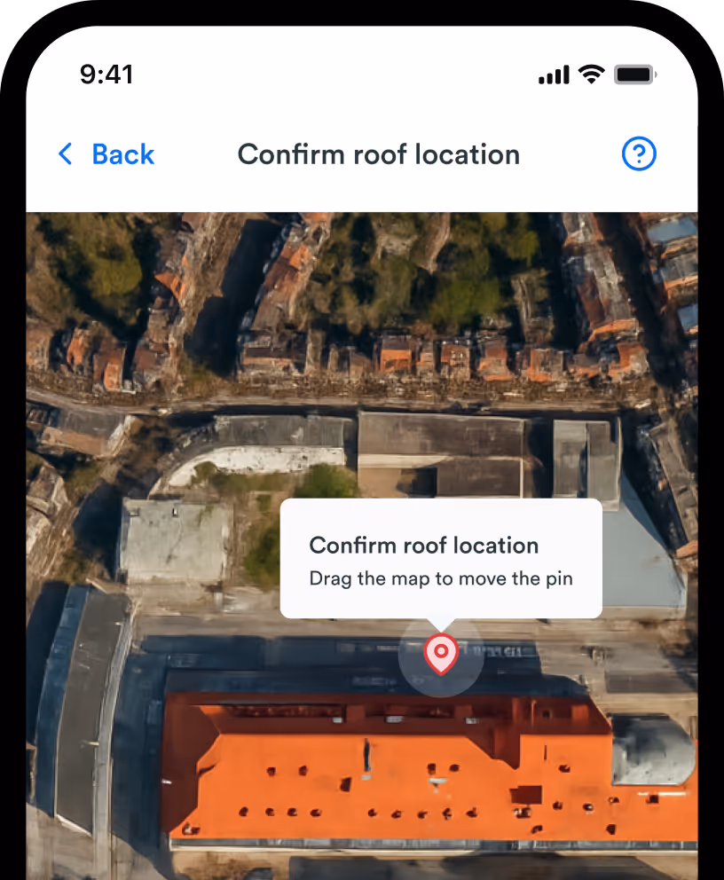
Step 1: Enter the property address.
Log into your Roofr account and type in the property address. The platform pulls up satellite imagery automatically, no site visit needed.
Step 2: Select your report type.
Choose between a full detailed report (with pitch, area, edges, waste calculations, and a roof diagram) or a quick estimate if you just need a ballpark for early-stage quoting.
Step 3: Receive your report in 2–24 hours.
Roofr's multi-check process means a human reviews every report before it reaches you. Paid plan subscribers get reports in as little as 2 hours.
Step 4: Import directly into your proposal.
Your measurement data flows right into Roofr's proposal builder. Material quantities, waste factors, and line items auto-populate, so you go from measurement to quote without re-entering a single number.
And that's it. Just four steps from inputting the address to sharing the proposal.
Satellite Roof Measurement FAQs
How accurate are satellite roof measurements?
Satellite measurements are accurate within 1–2 inches for standard residential roofs. That's good enough for estimates, proposals, and insurance claims. Accuracy depends on image quality and roof complexity, but for most residential jobs, satellite data is more than sufficient.
How much do satellite roof measurements cost in 2026?
Satellite measurement reports cost $10–$25 depending on the platform. With Roofr, they start at $19 per report on the free Starter plan and drop to $13 each on paid plans (Essentials and Scale).
Can satellite roof measurements be used for insurance claims?
Yes — most major insurance carriers accept satellite roof measurements for damage claims. Your report needs to include total roof area, pitch data, and key measurements like ridges and valleys. Having a detailed report ready before the adjuster shows up can speed things along and strengthen your documentation.
How fast are satellite roof measurements delivered?
Most reports arrive within 2–24 hours. On Roofr, paid plan subscribers get reports in as little as 2 hours. Starter plan users get them within 24 hours.
What's included in a satellite roof measurement report?
A full report covers total roof area in squares, pitch per slope, ridge/hip/valley lengths, eave and rake lengths, and a roof diagram. Some also include waste calculations and material lists. Roofr reports are six pages and cover all of these data points.
Do I need to visit the property to order a satellite measurement?
No — site visits aren't necessary for estimates, you just need the property address. You can order a report through the Roofr platform from your office, your truck, or anywhere with an internet connection.